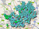
Genealogy in Hertfordshire

Introduction to Herts Maps

GENUKI has a simple map showing the historic parishes.

When you are researching your family tree it is essential to have a good understanding of the local geography, and fortunately there are a wide range of maps which you can use.

Early Maps: The earliest printed maps are of the whole county - the first was published by Saxton in 1577 - but there were many different maps - and some are reproduced online - and typically show at least the relative positions of the towns and villages. Some were printed as single sheets and some in atlases. In general it is not possible to  combine reasonable download times with high resolution, but for a comparatively high resolution early map (which may take several minutes to download) click here.

Route Maps: As travel became easier the need for travellers guides became more important and John Ogilby was a pioneer whose road atlas was published in 1675. Such maps not only show the road but also identify feature alongside it.

Ordnance Survey: The Army started producing 1 inch maps of the country in about 1800 and over the years many different maps, at different scales, have been produced. Certain of the maps series, from the 19th century to the present day, are readily available in printed form or online. In particular Old-maps allows online access to large scale ordnance survey maps, which, in Hertfordshire, were surveyed in about 1881.

Modern Maps: There are a wide range of modern maps - in tourist guides, motoring atlases, etc. The most useful online site would seem to be Multimap.

Genealogical Maps: Maps have been specially provided to help the genealogist.

Manuscript Maps: Not all maps are printed, and estate and tithe maps can contain very valuable information - sometimes down to the identification of the occupier/owner of an individual property. See Calalogue of Manuscript Maps

Gazetteer: These are geographical indexes, often with descriptions of places and maps.  One available on CD is Cassell's Gazetteer of Great Britain and Ireland, from the 1890s, while an earlier one is the Topographical Dictionary of England, published in 1831. The Little Guide for Hertfordshire (1903) (on CD) includes a gazetteer, a useful railway map, and a county map where you can zoom in for detail.

HALS has a large collection of maps, including large scale O.S. maps, while larger town libraries such as those at Hemel Hempstead, St Albans and Watford, have good collections of local O.S. and other maps.

Click here for Map Index

HOME

Last updated August 2006