|
The Maps of Hertfordshire The Road to Kings Lynn John Ogilby, 1719 |
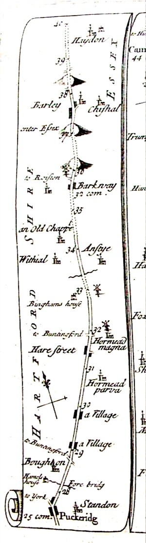 This is an example of part of an early strip
map detailing the journey from London to Kings Lynn, in Norfolk. with the
mileage from London being marked off along the route.
This is an example of part of an early strip
map detailing the journey from London to Kings Lynn, in Norfolk. with the
mileage from London being marked off along the route.
| Haydon | ||
| Barley | Chisal (Great Chishill) | |
| enter Essex | ||
| to Roiston (Royston) | Barkway | |
| an Old Chappel | ||
| Withial (Wyddial) | Anstye (Anstey) | |
| Binghams House | ||
| to Buntingford | Hormead magna (Great Hormead) | |
| Hare Street | ||
| Hormead parva
(Little Hormead) |
||
| a village (Dassles) | ||
| a village (Hay Street) | ||
| to Buntingford | ||
| Broughton (Braughing) | ||
| Hamels House | Fore Brig (over River Rib) | |
| to York | Standon | |
| Puckeridge |
See Also Strip Maps
For a discussion of the road south of Puckeridge see Village development along the Old North Road
Last Updated September 2004