W. Schmollinger's Map of Hertfordshire
1831-1852
Often referred to as Moule's Map of Hertfordshire
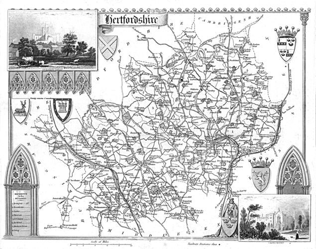
This map includes views of St Albans Abbey and Cassiobury, (Watford) and six shields. The panel in the bottom left lists the Hundreds, which are indicated by numbers on the map. The scale was approximately 5 miles to the inch, and was based on the larger scale map by William Ebden of 1825, which in turn was based on the original survey and map of Andrew Bryant of 1822.
This map was first published in 1831 in Moule's English Counties ... The English counties delineated, or descriptive view of the present state of England and Wales; illustrated by ... a series of forty county maps ... by Thomas Moule, and carried the signature "Engraved for MOULES' ENGLISH COUNTIES, by W. Schmollinger." Later it was included in A complete and universal English Dictionary, by the Rev. James Barclay, illustrated by numerous engravings & maps, between 1842 and 1852.
The map is number 94 in D. Hodson's The Printed Maps of Hertfordshire 1577-1900 and he records 8 versions of the plate. The most noticeable changes record the addition of the railway lines - the London & Birmingham railway appears in 1837, the Northern & Eastern railway in 1842, with the Hertford branch in 1844.
The version shown above is Hudson's reference 94 (viii) and appeared in editions of Barclay's dictionary between 1845 and 1852.
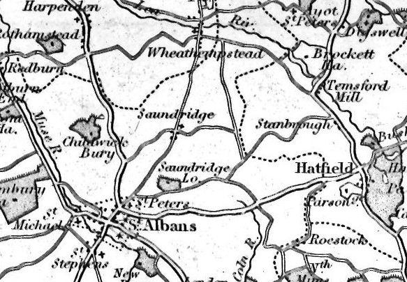
The above detail shows the parish of Sandridge
Page created November 2008