|
The Area around Braughing 1808 |
|
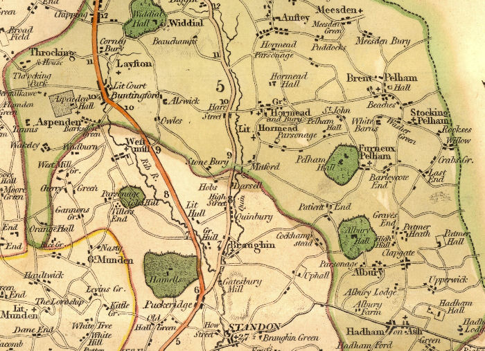
This section of Charles Smith's Map of Hertfordshire (1808 edition) is centred on Braughing and the River Quin, with the nearby villages (from the North, clockwise) Wyddial, Anstey, The Hormeads and Pelhams, Albury, Hadham, Standon, Puckeridge, The Mundens, Aspenden, Throcking and Layston. The River Rib is also shown north of Standon.
Page created December 2008