Charles Smith
A New Map of the County of Hertfordshire
Divided into Hundreds
Various editions 1801-1839 and later
This map was based on the Dury and Andrews map, and is reproduced at approximately 2 miles to the inch. It is the first map of the county to show longitudes measured from the Greenwich meridian. It was published in Smith's New English Atlas, and also issued in separate sheets. More information about the map is given in Printed Maps of Hertfordshire.
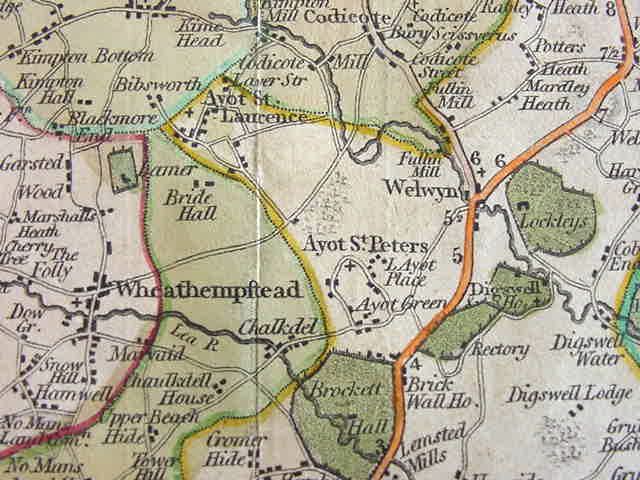
Detail from the 1808 edition