|
The 1838 Enclosure Map Little Gaddesden |
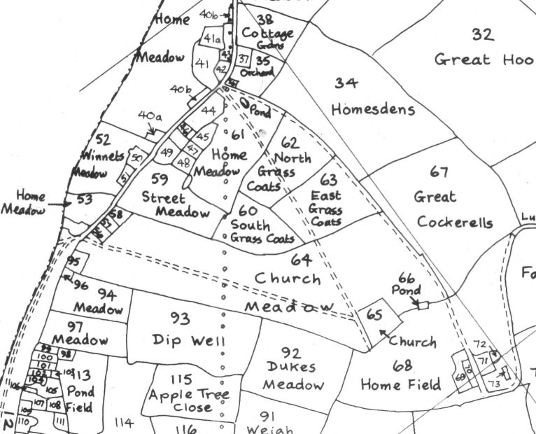
The above is a small section of the composite map, giving the field names in Little Gaddesden and Hudnall, based on the maps and schedules dated 1838 for Little Gaddesden and 1868-74 for Edlesborough. It was drafted by J. Leonhardt and is reproduced in full in Little Gaddesden Church and Little Gaddesden and Ashridge.
The line of dots represents the believed line of an old Roman road from Verulamium.