A Short History of Bernards Heath
How Big was Bernards Heath?
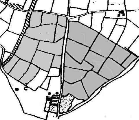
Over the centuries common land, such as Bernards Heath, became enclosed and the inhabitants lost their rights to graze their sheep and cattle, and to run their pigs in the woods after acorns. It seems very likely that Bernards Heath was once much bigger than it is now. Unfortunately apart from a few minor enclosures, such as the windmill and associated land leased to William Franklyn in 1687, and the triangle of land occupied by Benjamin Fowler, brickmaker, in 1813, no records survive. Unfortunately it seems likely that a large area was enclosed before the estate map of 1726 was drawn up. The field names given - such as Eight Acres - especially to the west of Sandridge Road - suggest no great antiquity and in the above map the fields have been grouped together by name and 1726 owner, and it is very likely that sometime in the 17th century the shaded areas were part of the common land called Bernards Heath, bounded on west by Beech Bottom and to the east by Marshalswick.
There were older closes adjoining Stonecross, together with a group of three, Brick Close, Brick Meadows and perhaps Harvey Close, which were associated with brickmaking