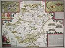
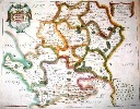
The first printed map of the County of Hertfordshire was produced by Christopher Saxton in 1577 and while it names a large number of villages it is not very detailed and does not show the roads. It is reproduced, together with many other early county maps in the book County Maps & Histories Hertfordshire, which is a short history of Hertfordshire illustrated by a series of coloured illustrations of County Maps. There were many different maps published in the 17th century - some of which were merely copies of earlier maps. Two of these, published by John Seller in 1676 and by John Oliver in 1695 were reprinted in Four County Maps of Hertfordshire. Robert Morden's map, first published in 1695, was included in the Gibson's translation of Camden's Britannia.
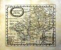
The number of maps published in the 18th century increased still further, and that of John Warburton, published in 1749, and reprinted in Four County Maps of Hertfordshire, is sufficiently detailed to show some of the larger farms. However the best 18th century map, in term of the detail shown, was produced by Andrew Dury and John Andrews on nine sheets in 1766 at a scale of nearly 2 inches to the mile. It has been reprinted in book form as A Topographical Map of Hertfordshire and reprinted as sheets with an index by the Hertfordshire Record Society
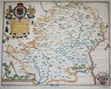
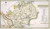
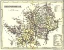
Moule's Map of Hertfordshire, 1837
From the Gillmark
Gallery Catalogue
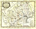
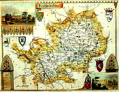
In the 19th century further series of county maps were printed - such as the maps in Moules' English Counties - but the coming of the Ordnance Survey made it uneconomic to carry out new surveys and one of the last was by Bryant in 1822. It has been reprinted in Four County Maps of Hertfordshire and reprinted as sheets with an index by the Hertfordshire Record Society.
Many of the county maps were published as a collection of county maps in an atlas - and while the original atlases are very hard to come by several have been reprinted (although may now be out of print). Three known to me are:
A detailed reference work listing the county maps - Printed Maps of Hertfordshire 1577-1900 - gives details of the map makers and the different versions of the maps.
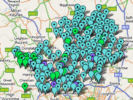
Maps not only differ in scale, but also in the amount of detail they show, and for comparison purposes details are given on the related web pages about how much detail the maps show of the parish of Sandridge.
Page revised Novenber 2008